


History
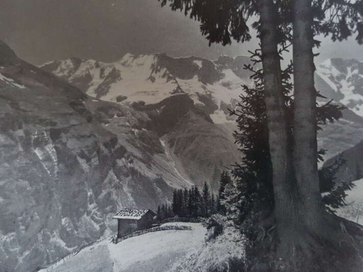
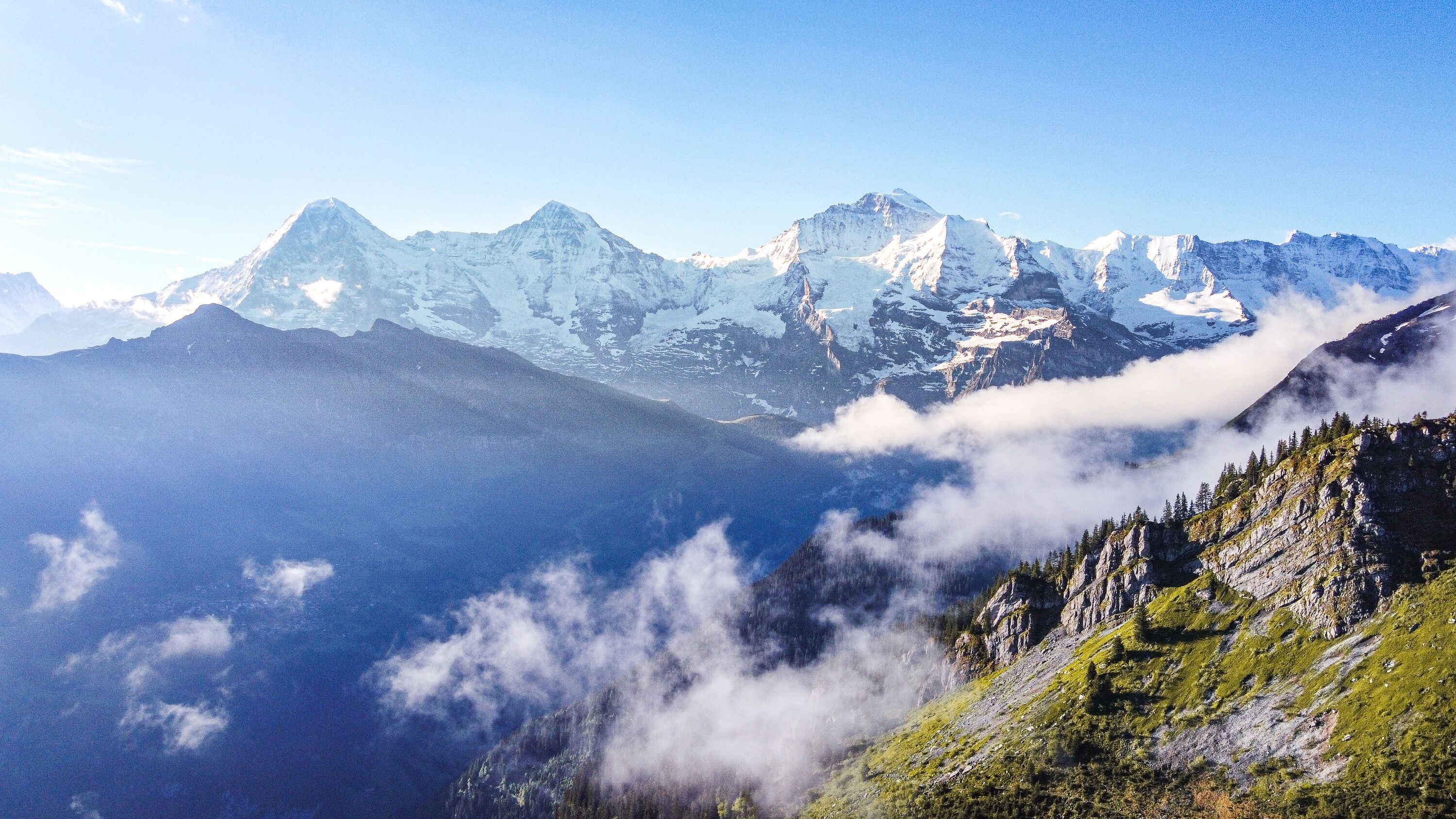
Entry on the Lauterbrunnen Valley in the Great Herder (1931): "Famous Swiss Alpine valley in the Bernese Oberland south of Interlaken, between Gschpalte- and Breithorn, Tschingelgletscher and Zweilütschinental; 18 km long, up to 1 km wide, 500-700 m deep (classic trough valley), crossed by the Weisse Lütschine, which forms numerous falls, especially the 260 m high Staubbachfall".
But even before the valley became famous, the villages were already populated. They were given their current names: Wengen, Mürren and Lauterbrunnen.
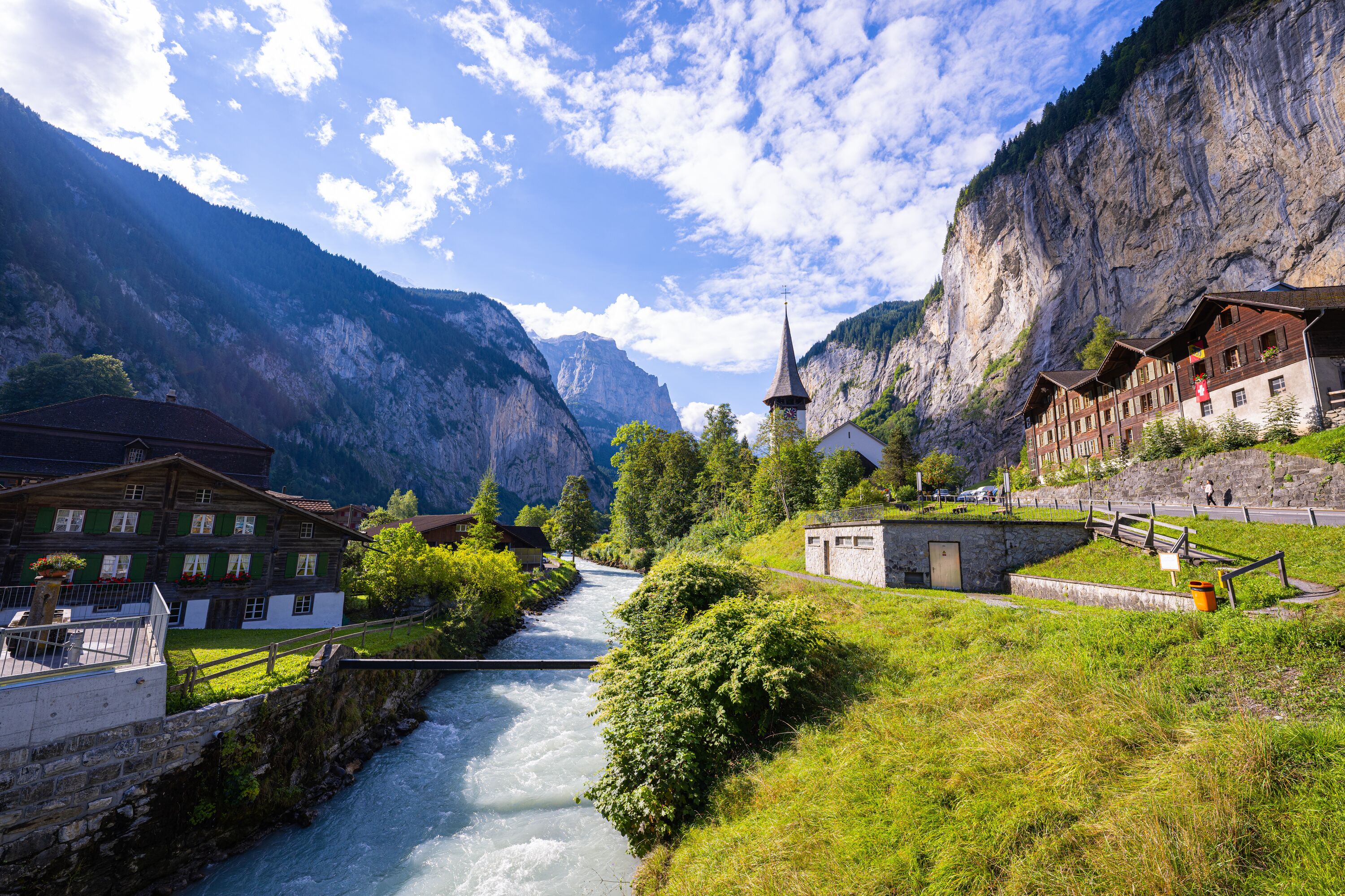
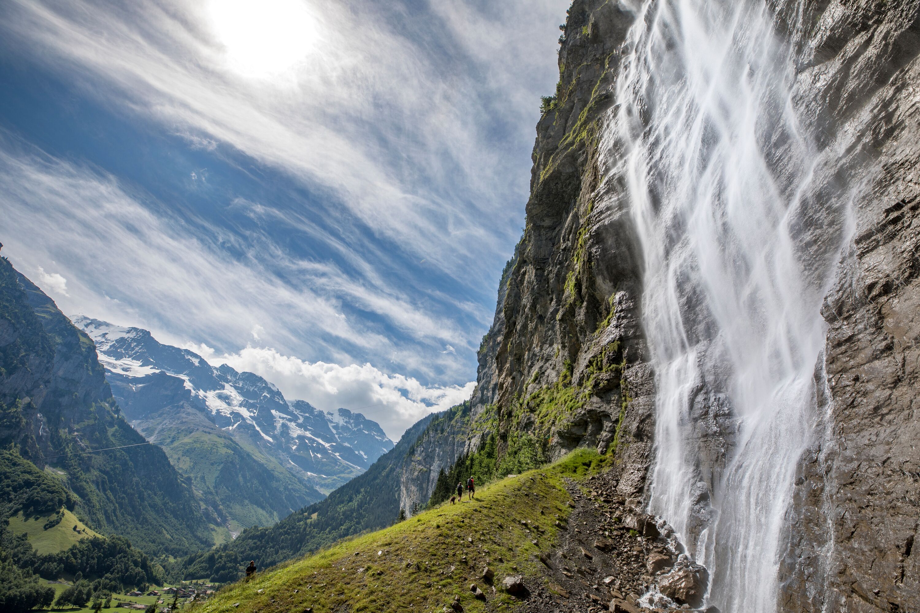
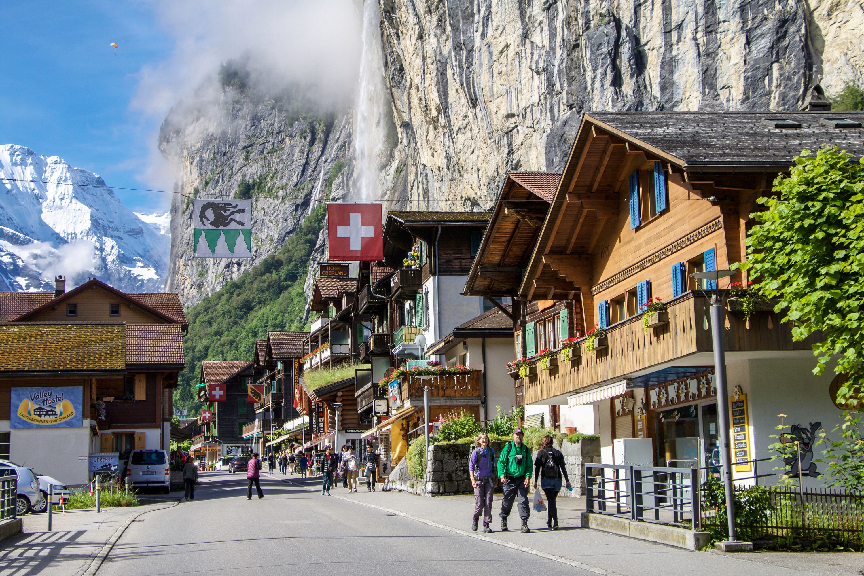
On the way there - or at the latest on the way back - to the Jungfraujoch-Top of Europe, we come across the village of Lauberhorn. For lovers of the fast disciplines in skiing, this place name is linked with its own memories anyway. If we let our gaze wander over the valley floor, we see the highest settlement. A place where James Bond was in action. If we look down, we come across what is now Rivendell, the western gateway to the Jungfrau Region. None other than J.R.R. Tolkien and Johann Wolfgang von Goethe have left their mark here. Nowadays, tourists from all over the world travel to the Lauterbrunnen Valley to experience the steep rock faces and numerous waterfalls up close.
A migration on a small scale: The Walser mainly came to the Bernese Oberland from the Lötschental, the Goms and the southern side valleys of the Valais.
Using the parish registers, we can calculate how many people were born and died in a parish. In the Lötschental, or more precisely in Kippel, around 1200 more people were born than died between 1714 and 1914, according to the registers. Strange. This leads us to conclude that the inhabitants simply migrated during these 200 years - mainly to the Lauterbrunntal in the Bernese Oberland.
We are relatively best informed about the Lötscher of Lauterbrunnen.
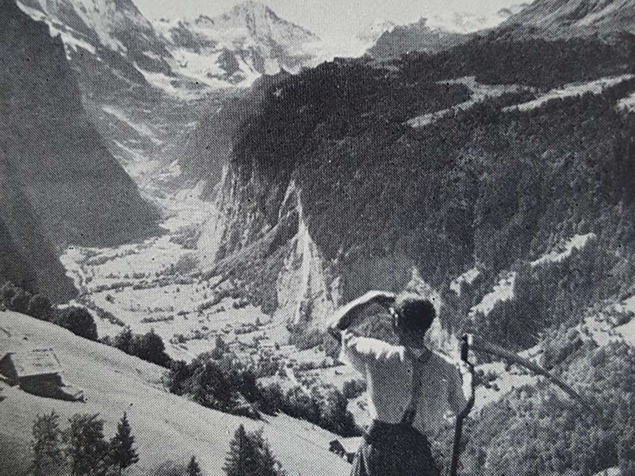
Hiking has always been the order of the day.
At the end of the High Middle Ages, the Walser settled in the Lauterbrunnen Valley from what is now the canton of Valais. The Walser found a crossing point at the so-called Lötschenlücke.
The Walser people are said to favour high terraces and valley floors - they were probably quite astonished when they passed the Lötschenlücke and entered the Lauterbrunnen Valley: The valley fulfilled the requirements perfectly...
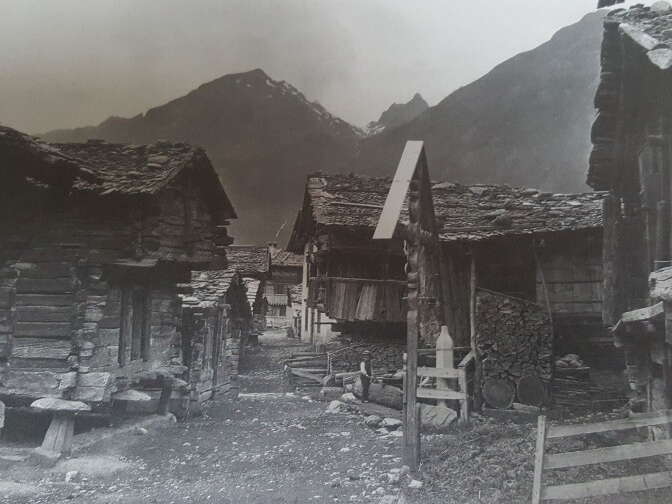
The valley floor used to be sparsely populated. Probably only those parts of the trough valley that were protected from flooding. The summer floods of the Lütschine had almost the entire valley floor firmly in their grip. At the time, the Lütschine flowed through the bottom of the valley at a steady pace.
The peculiarity of almost all Walser settlements is their geographical location on the highest altitude terraces and in the furthest valley areas, which are separated from the lower settlement areas by gorges, impassable valley bars or arduous steep climbs. What place could be better suited to this than Mürren?
Far away from civilisation in the seclusion of the bottom of the valley or on high terraces, the miners lived their own lives as exclusively self-sufficient people.
Mainly due to the danger of water and avalanches on the valley floor, only the high places were populated at first.
Living proof of this has survived to this day. The inhabitants of the valley floor in Lauterbrunnen were not so numerous that they were able to form their own "Bäuert". They still belong today, by family, to the three "Bäuerten" of Wengen, Mürren or Gimmelwald, where each enjoys farming rights in the place they once left.
With the improvement of the road conditions on the slopes and on the valley floor and the damming of the Lütschine, the front and rear ground became more populated.
Sister of Rivendell
There is something mystical about this Lauterbrunnen - especially when it is shrouded in such clouds of mist. Just as interesting as the valley itself is the question of the village and valley community name: There are no fewer than four interpretations.
Lauterbrunnen takes its name from a spring, the clarus fons, which bursts out of the ground.
The streams that together form the Luterbach have their origins in strikingly "louder" springs. These have their sources close to each other and their water is (who would have thought it) always clear - even if the water in the other streams is cloudy when the snow melts or during thunderstorms.
Places or sites where water was drawn were characterised by their constant clarity and "purity". These had to be distinguished from neighbouring springs. To make this distinction clear, a common name was used today: fountain. It is therefore not surprising that farms grew up around such "clear wells", which then became the centre of a settlement. In our case, this was probably the Ey and the elevated Wytimatten.
Analogous to the naming in the Alemannic areas, the valley name can only refer to these "luuterren Brunnen". The name was usually first applied to the settlement and then to the entire valley. This proves that the Lauterbrunnen Valley was (and of course still is) a place of constant, good water supply.
That clears up the matter of the valley's name. In old documents, the place name is called "in claro fonte", which means "to the clear spring" or "to the bright springs". Fons (fontis, nominative, singular) is translated in classical Latin as source or origin. However, the Latin in the documents has little to do with classical Latin and is rather a translation of existing German expressions.
The name "in claro fonte" is used for Lauterbrunnen for the first time to our knowledge in the second volume of the "Fontes rerum bernensium" on 2 October 1240. Translators familiar with the area first rendered it as "Hellbrunn" and then, at the beginning of the 19th century, even as "Schönbrunn". In the Interlaken document book 110a from the 17th century, the name is correctly translated (as in earlier documents) as "Luterbrunnen" according to the vernacular.
The last two syllables of the valley and place name ("brunnen") occur in many different ways - but only in the sense of "spring". This is confirmed, for example, by "Das Brunni" in Wengen or the "Schmadribrunnen" high up between the moraines of the Breithorn and Schmadrigletscher glaciers.
297
metres high is the Staubbach Falls, which made Lauterbrunnen famous at the beginning of the tourist trade in the second half of the 18th century. Today, the centre has shifted from the Ey to the railway stations - as a transport hub for all the villages in the valley.
The Lauberhorn village
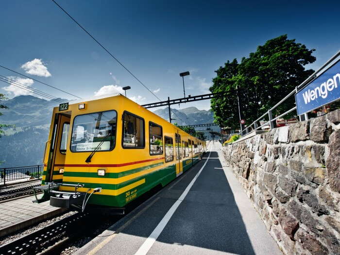
From Lauterbrunnen, take the Wengernalp railway up to Wengen. Wengen is the largest village in the Lauterbrunnen Valley and lies at 1274 metres above sea level. The village name was first mentioned in a bill of sale from 1268 as "on the Wengen mountain".

One of my islands is Wengen - the one in the mountains.
Wengen is the plural form of "Wang". This immediately makes us think of our red cheeks (especially in winter) - in our dialect, the term "cheeks" has been preserved as part of our facial features.
In the plural form, "Wang" has taken on the ablaut. In other words, "a" was converted into "e". This then gave rise to the derivation of the place name.
The meaning of the word has also become part of the landscape name. "Wang" refers to a more or less steep slope.
The place name usually appears in the documents in the form "uf Wengen" or "uf dem Berg Wengen". It is therefore natural to assume that the name was given by observers at the bottom of the valley. From this perspective, the statement "auf den Wengen" is also entirely correct.
35
train arrivals from Lauterbrunnen are currently recorded per day in Wengen.
The charming village at the foot of the Schilthorn
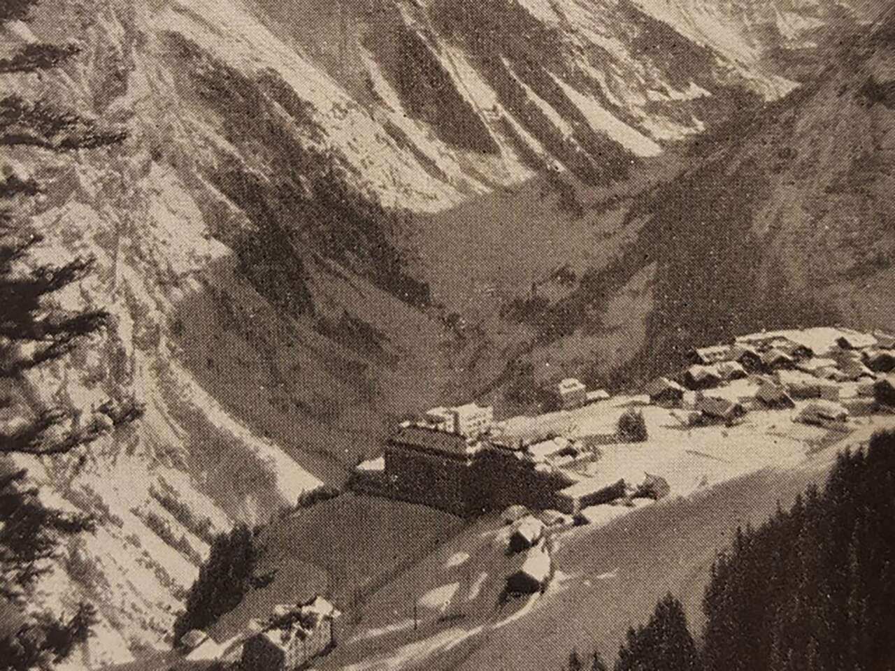
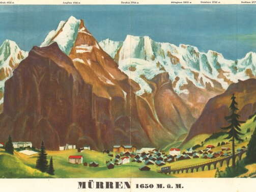
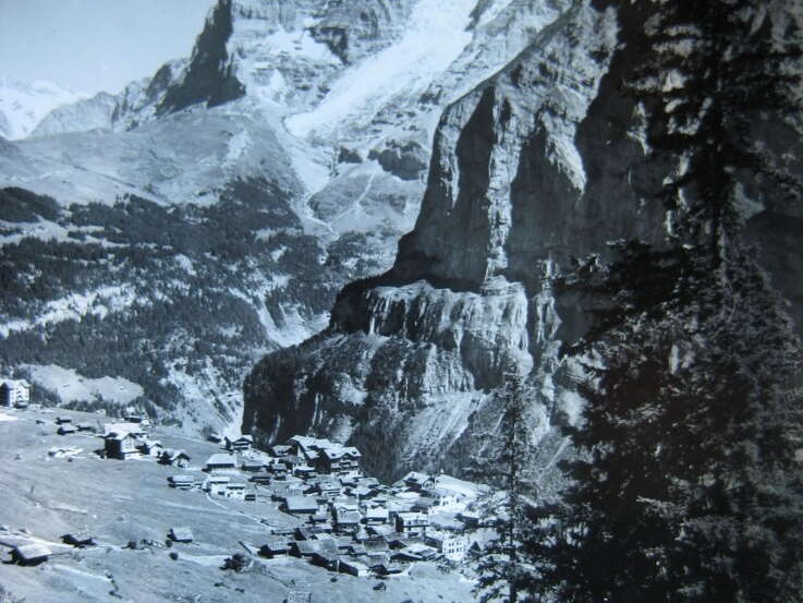
The highest permanently inhabited settlement in the canton lies at 1650 metres above sea level and bears the name: Mürren. There have been many different spellings over the centuries. Montem Murren (for the first time in 1257), Murron, Murn, Mürn, Murne, Myrrhen and Mürren.
In contrast to Wengen, Mürren is a so-called "Spisse"
We derive the word "Spisse" from the Latin adjective "spissus, spissa, spissum", meaning "crowded together". In other words, Mürren is a spatially sharply separated settlement area.
A stream (Spissbach) on the valley floor also bears this name directly.
The village is situated on the top of a wall on the 700 to 800 metre high Fluh. The name is therefore obviously derived from the Latin "murus" for wall.
The Walser influences cannot be hidden in Mürren. There are also numerous parallels in the dialect.

Nun, ich bin ein äusserst heterosexueller Mann und ich erinnere mich natürlich an all die hübschen weiblichen Geschöpfe, die mich umgaben. Ich gebe zu, die Pracht der Berge habe ich erst nach drei Tagen wahrgenommen. Ich verbrachte während der Dreharbeiten sechs Monate in Mürren und ich beklagte mich nie.
NOMEN EST OMEN
The name is a sign. The Roman poet was right, of course. When people think of Wengen, Mürren and Lauterbrunnen, that can definitely be said - without blushing.
More information
Talmuseum Lauterbrunnen
More information
Photos: Jungfrau Region, Jungfraubahnen
Story: André Wellig
Autumn 2017
Contact
Jungfrau Region Tourismus AG
Kammistrasse 13
CH-3800 Interlaken
Tel. +41 33 521 43 43
info@jungfrauregion.swiss
![]()

